From our garden … a simply spectacular view, from the Tuscan hills of the high Maremma to the Tuscan sea. The alternative to relaxation in our country house is there and we are always available to offer you interesting itineraries also considering the weather conditions that accompany your stay. Sites of historical and archaeological interest and places where nature meets a beautiful sea.
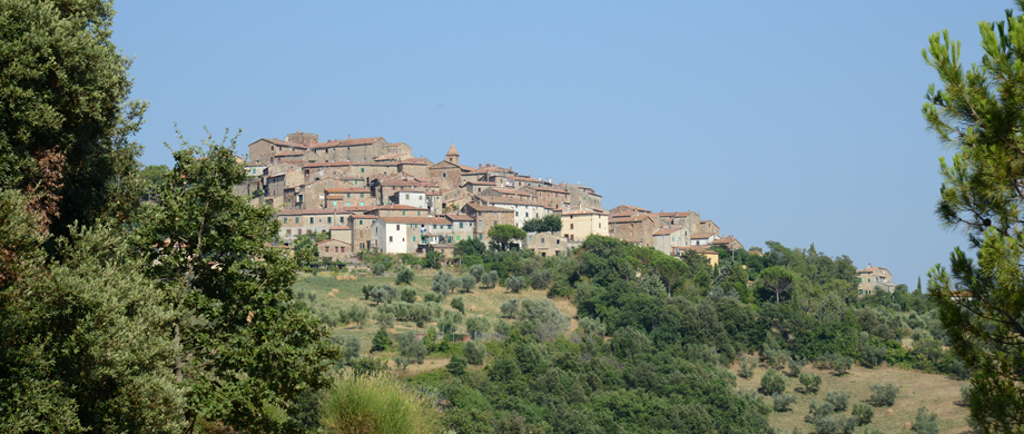
Tatti
985/5000
It is also known as “the country of the swallows” and is the closest to Nocini di Maremma, at a walking distance. Legend has it that those who want to return to Tatti must go to the square of the cistern and make three turns around the cistern itself. Walking through the alleys of the village you immediately feel the ancient and medieval flavor that characterizes this country. Narrow streets, arches, walls, cisterns, mills and churches are the protagonists of this place out of time. At the end of October there is the Autumn Flavors Festival: there will be many specialties of the local rustic cuisine included in the menu of the festival, with dishes such as wild boar, polenta, grilled sausages, mushrooms, roast chestnuts, bruschette. During the festival there are also various events such as street musicians through the streets of the town. You can also visit the traditional cellars and old mills in the area.
Do not miss … vising Tatti during celebrations time is a unique experience !!
Massa Marittima
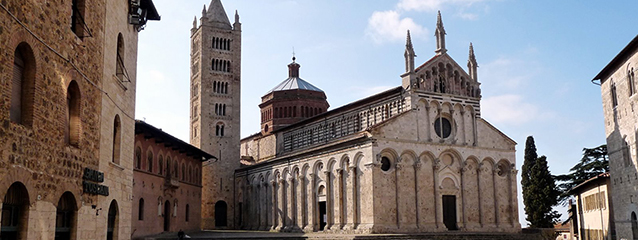
It is considered one of the medieval gems of Tuscany. It offers a wonderful historical center, the Cathedral of San Cerbone, the municipal palace and the Praetorian Palace, the medieval walls, the Sienese fortress and the candlestick tower, the “scandalous” source of abundance, the impressive museum of the mining and much more..
Coordinates: 43 ° 03’00 “N 10 ° 53’37” E
Altitude: 380 m s.l.m
Distance from Tatti: 23 km
Follonica - Torre Mozza
There are both bathing establishments and free beaches.
The environment is wild, composed of sandy dunes and reeds.
Coordinates: 42 ° 56’44.2 “N 10 ° 41’38.85” E
Distance from Tatti: 37 km
Near: Follonica 3 km
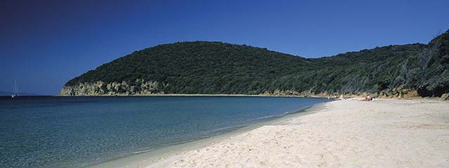
Punta Ala - Cala Civette
Famous seaside resort, formerly known as Punta Troia, was the Italian aviator Italo Balbo, who had purchased some fortifications and villas in the area and which later became his residences, to change its name to Punta Ala, drawing it from aeronautical jargon. The wildest and most hidden beach of the Gulf of Punta Ala is CALA CIVETTE which takes its name from the Tower that dominates the bay: Torre Civette. Equip yourself as there are no bathing establishments or bars or refreshment points.
Coordinates: 42 ° 84’78.93 “N 10 ° 77’55.93” E
Distance from Tatti: 39 km
Near: Punta Ala 6 km
Montemassi
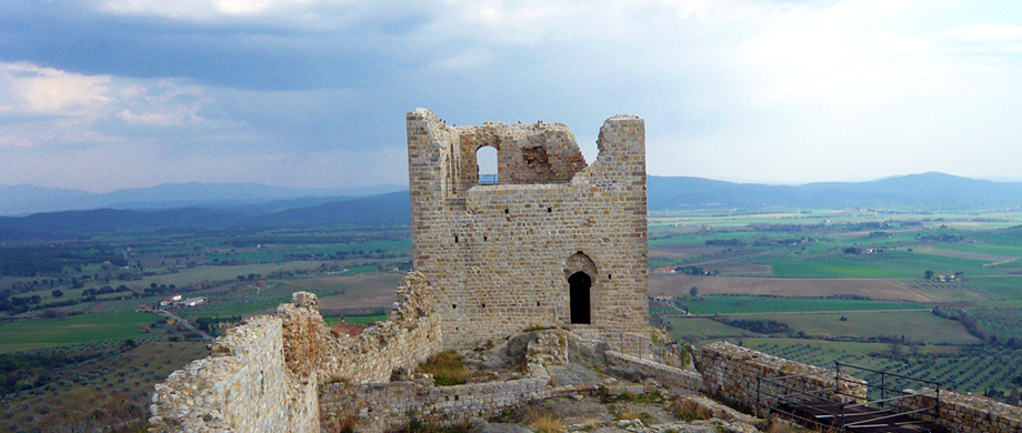
Medieval village of which still retains its picturesque “pine cone” appearance. Known for its Castle depicted in the famous fresco ‘Guidoriccio da Fogliano at the siege of Montemassi’ of the public palace of Siena attributed to Simone Martini. From the majestic remains of the Rocca, you can admire a superb panorama.
Coordinates: 42 ° 59’32 “N 11 ° 03’50” E
Altitude: 140 m s.l.m
Distance from Tatti: 11 km!
Chiusdino
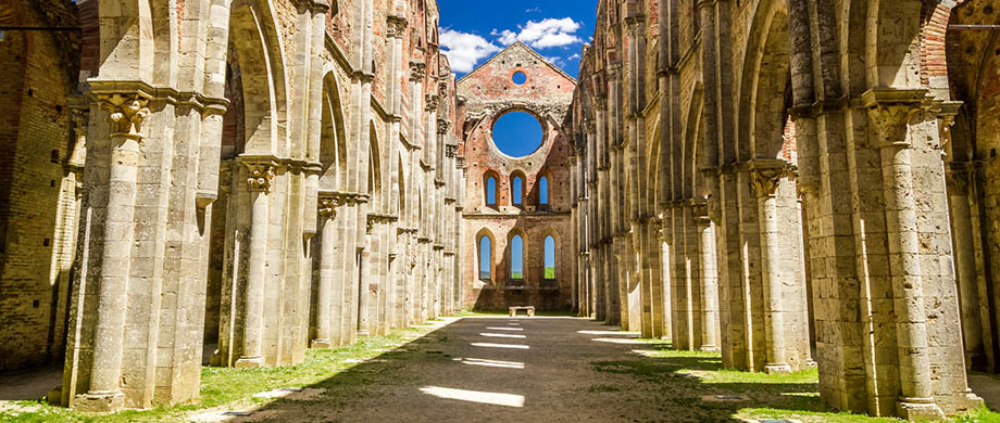
A tourist destination is definitely the Hermitage and the Abbey of San Galgano. In an isolated valley between the hills, there is this ancient and grand abbey, now deconsecrated and partly ruined, and 50 meters higher up, on the hill of Montesiepi, a small circular chapel inside which there is one of the most fascinating and mysterious” relics ” of the whole Tuscany: the sword in the rock of San Galgano.
Coordinates: 43 ° 08’57.87 “N 11 ° 09’20.26” E
Altitude: 564 m s.l.m
Distance from Tatti: 23 km
Grosseto
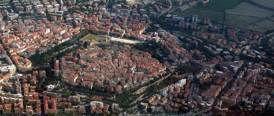
It is the capital of the Maremma. The historical center is entirely included within the perimeter of the Medicean walls and in it are concentrated the main monuments and the best shops so it deserves a thorough visit.
Coordinates: 42 ° 46’20 “N 11 ° 06’32” E
Altitude: 10 m s.l.m
Distance from Tatti: 37 km
Scarlino - Cala Violina
Near the sea, on a suggestive hill overlooking the Gulf of Follonica and the Elba island there is the medieval village of Scarlino, surrounded by a territory rich in natural environments and cliffs that encircle enchanting inlets. The long walk to get to these two coves (a stretch of the path is forbidden to all motor vehicles and you can get to the beach only by foot or by bike), satisfies the eyes and the spirit, crystal clear water, white sand and rocks … A perfect mix. The beach owes its name to the white and very fine sand that distinguishes it, so particular to reproduce a sound similar to that of a violin when you walk barefoot. It is good to leave equipped because there are no bars or umbrellas.
Coordinates: 42 ° 51’20.2 “N 10 ° 46’27.6” E
Distance from Tatti: 38 km
Near: Scarlino 9 km Punta Ala 8 km
Castiglione della Pescaia - Rocchette
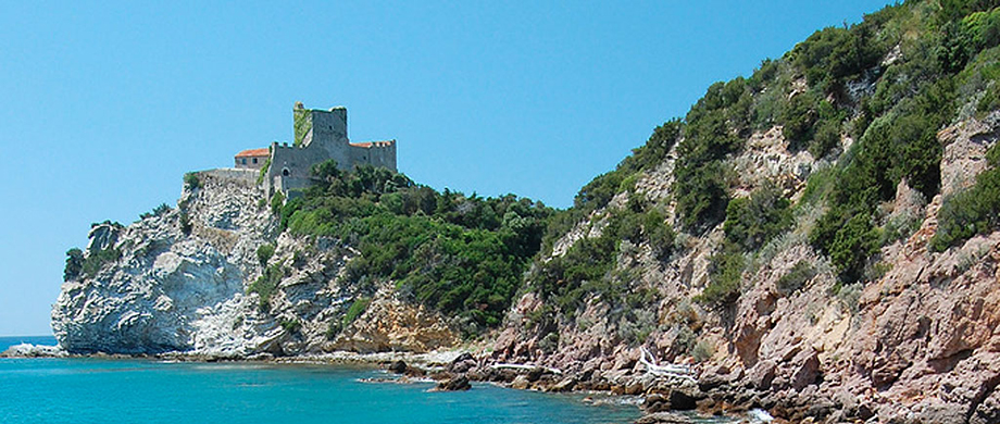
The village is enchanting, a pearl set on the Maremma coast. A medieval village with lots of fortified walls and Castle overlooking the sea! North of Castiglione one of the most beautiful beaches of Italy, the ROCCHETTE, embellished with fine sand and also a cliff made of polished rocks, bathed by an intense blue-green crystalline sea. On-site bathing establishments, guarded parking lots and restaurants.
Coordinates: 42 ° 46’23.77 “N 10 ° 47’24.74” E
Distance from Tatti: 48 km
Near to: Castiglione della Pescaia 9 km
